Abstract
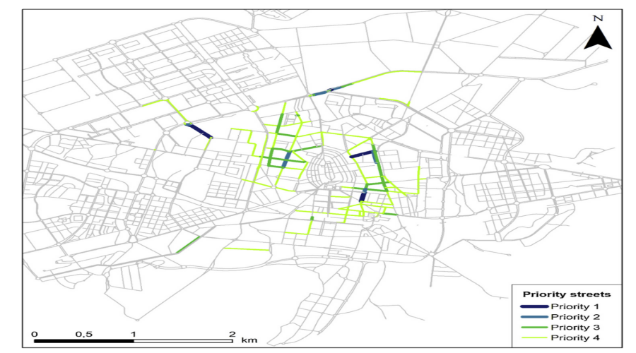
Pedestrian-oriented urban designs are sustainable from a mobility perspective, and could therefore be used to improve urban environments. This study proposes an analogy between the ecological idea of habitat and the pedestrian urban environment and introduces the concept of “pedestrian habitat quality”. We present a methodology based on this concept to measure pedestrian habitat suitability in an urban street network, combining network kernel density estimations with a habitat suitability model. The dimensions of proximity and walkability connectivity are first incorporated in the methodology through network kernel density estimations, and the micro physical environmental factors relevant for pedestrians are considered using a pedestrian habitat quality model. The final outcome of the methodology is an identification of priority streets for action in order to improve pedestrian mobility. The methodology was applied to Vitoria-Gasteiz, a medium-sized city in northern Spain. Our results for Vitoria-Gasteiz show that the streets with a greater potential for improvement are situated in the surroundings of the city centre and in industrial edges that serve as a link to residential zones. It has been demonstrated that the methodology could be a useful tool for urban and transport planners to identify priority streets on which to focus efforts for improving urban environments.


